Welcome to SurveyLabs

Your partner in aerial survey, mapping and 3D reconstruction

CONTACT US

Features


Aerial video survey

We provide aerial survey and mapping solutions.

DEM and 3D reconstruction

Building high precision Digital Elevation Models (DEM) and creating 3D models of buildings, fields, construction sites.

Lidar survey and thermal imaging

We offer lidar surveys and thermal imaging using state of the art hardware.

Resources


DJI M600 Pro
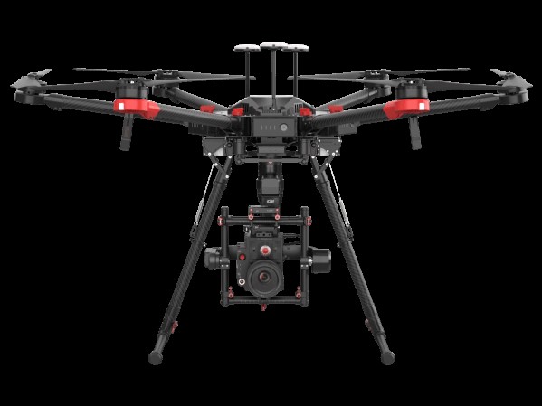
The Matrice 600 Pro platform is designed for professional aerial photography and industrial applications. With 6kg payload it is able to carry Lidar and DSLR cameras.

DJI M300 RTK
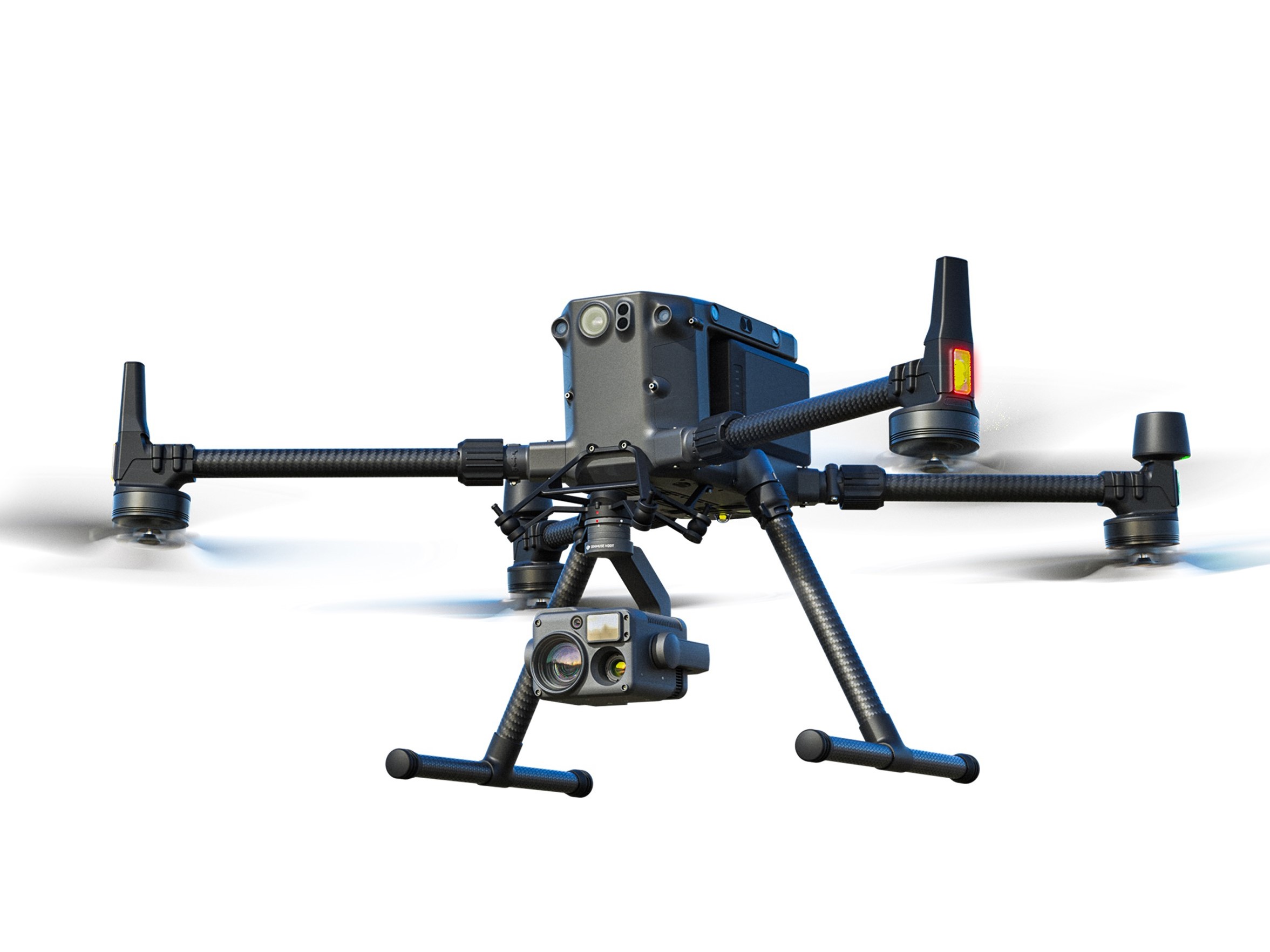
The Matrice 300 RTK is DJI's latest comercial drone platform. Offering up to 55 minutes of flight time, with powerful H20T camera and RTK precision we are able to produce high resolution maps, DEM-s and thermal maps.

DJI M3E and DJI M3T
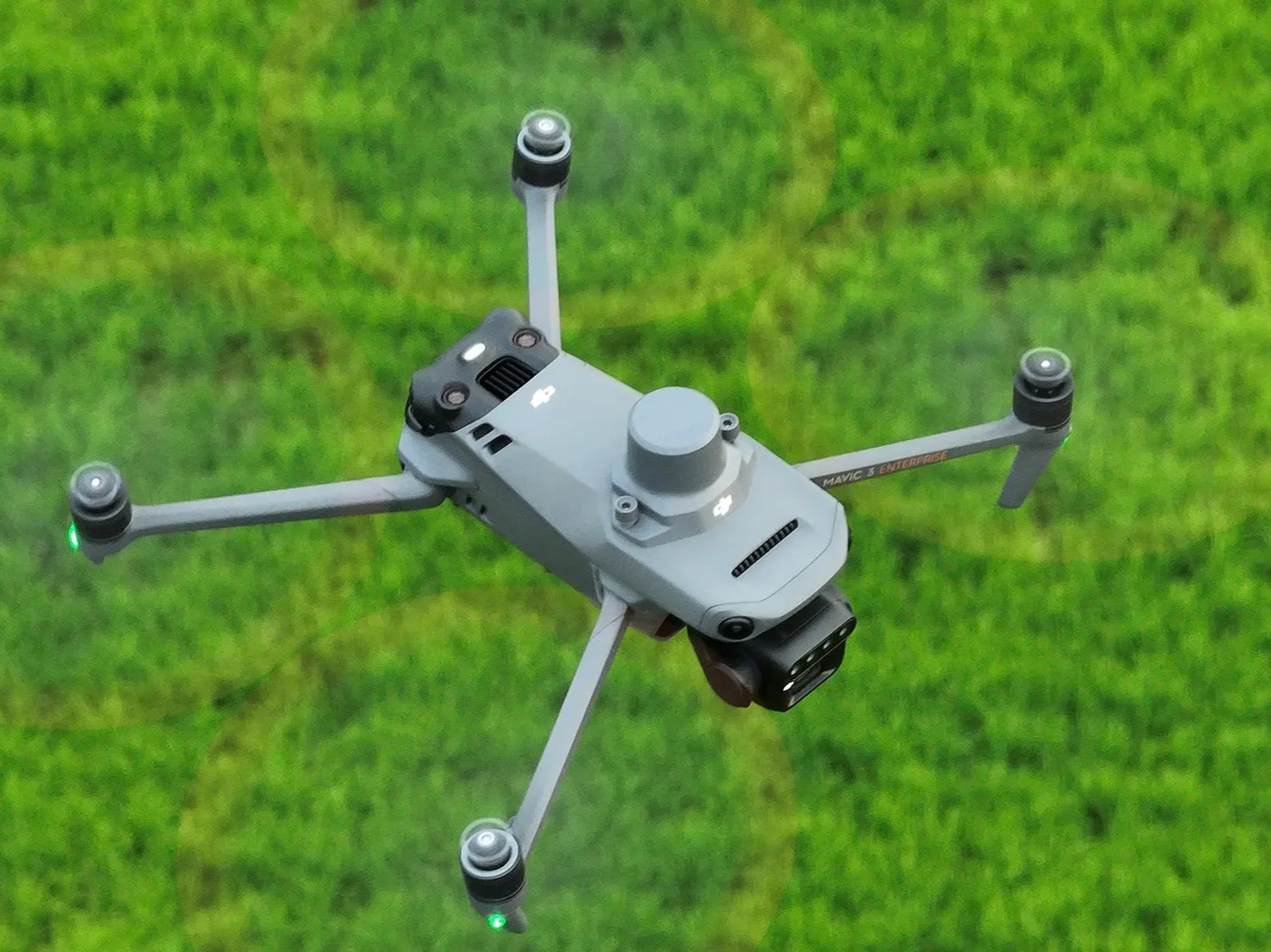
The DJI Mavic 3 Enterprise and Mavic 3 Thermal drones are advanced tools designed for professional use. The Mavic 3 Enterprise features a high-resolution camera and robust navigation, ideal for surveying, mapping, and inspections, with extended flight time for comprehensive data collection. The Mavic 3 Thermal includes a thermal imaging camera, perfect for search and rescue, firefighting, and infrastructure inspections, allowing detection of heat signatures and temperature variations. Both drones offer exceptional performance making them essential for demanding professional applications.
Projects


ESB

InishMaan

Tralee orthomosaic.
Our orthomosaic viewer. Kinsale

About Us


Dr. Gerard Dooly has worked extensively in field robotics for over 10 years. His research interests include real-time 3D reconstruction, optical fibre sensors, subsea structural health monitoring, teleoperation and automated docking & intervention. He is focused on the design and development of robotics and has engaged in numerous field operations and survey missions both here in Ireland and on the continent.
Dr. Petar Trslic. His research interest includes aerial UAVs and underwater unmanned vehicles, computer vision, advanced sonar and lidar operations and image processing. Petar is an experiened UAV pilot with multiple flight missions performed in highly challenging environments (GNSS denied environment - within Arctic Circle, nightime flights, flying offshore, on the airports etc)

Contact Info
info@surveylabs.ie

© P.T.-SurveyLabs